There is a decoration based on some photographs of a robin I took this morning. To download the PDF file (about 1Mb) which you can print as a single A4 page right-click on this link Robins decoration and select Save link as/Save target as.
Author Archives: John
Hungary Interlude map
This Google map shows an outline of our route; the place markers are accurate but the road route is just the Google maps calculation between those place markers rather than the detailed route.
You can drag the map around and zoom in for a more detailed view.
A few minor changes
There is an additional menu item under the title image for Restaurant photos.
The image on the Home page (https://asoelie2e.fr/) is a rotating panorama (using Adobe Flash Player). On the other pages it is a static photograph. The file size is similar to the ordinary image so should not take any longer to download but the rotation will use more of your computer processor. Hopefully this will not cause any problems?
Under the image at the top of all the pages there is a grey scale with eleven gradations from black to white and ten more back to black. If your screen is adjusted correctly you should be able to see all the shades of grey.
Champ de Roches (Field of Rocks) near Barbey-Seroux, Vosges
The Champ de Roches (Field of Rocks) is now hidden in a pine forest just off a forest track about 15km SW of Entre-deux-Eaux (Google maps satellite view). The large blocks of granite are in a roughly rectangle area about 40 by 400 metres and are about 7-8 metres deep. There is no definitive answer to the formation of the field but it is assumed to be due to glacial action. However the rocks do not show any scuff marks so can only have travelled a short distance; sudden melting of a glacier could be an explanation.
In earlier times local people moved some of the rocks to create boundary walls around the nearby land which they farmed but these are now not so easy to see since the area has been planted with trees.
Click on link Champ de Roches to go to the page containing the 360˚ panorama
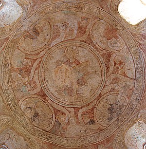
12C fresco at St Ulrich Chapel, Avolsheim, Alsace
On our way back from a lunch at the Le Cerf, Marlenheim (one Michelin *) we stopped at Avolsheim to see the Romanesque churches which are among the oldest in Alsace.
Unfortunately the eglise de Dompeter (built about 1050) has undergone significant restoration and little of the Romanesque building remains visible except the column bases and a few stones in the walls.
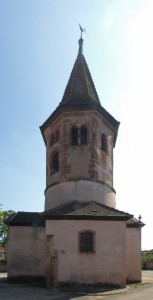
There is another chapel in the village, St Ulrich, which may once have been the baptistry to a now-demolished larger church. It contains some 12C frescoes which were rediscovered in 1967/8 when some whitewash was removed. The chapel was built at the end of the 10C with the belfry drum added in 1160-80.
Click on the photograph or the link below to go to the page containing a 360˚ panorama of the interior of the chapel
12C Fresco, St Ulrich Chapel, Avolsheim, Alsace
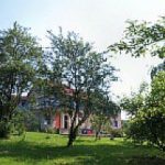
Summer in the orchard
Three panoramas in and to the side of the orchard late June/early July 2010. The second and third panoramas are views adjacent to chairs and tables Ann and David Hart used when seeking cool shady spots for reading (or sleeping!) during their visit.
Click on the photograph or the link below to go to the page containing the 360˚ panoramas
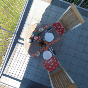
Breakfast on the balcony
He’s always on the phone
To Portugal and back map
This Google map shows an outline of our route; the place markers are accurate but the road route is just the Google maps calculation between those place markers rather than the detailed route.
You can drag the map around and zoom in for a more detailed view.
Early spring in the orchard
Despite the long cold, snowy winter the flowers have started to bloom in the fields and orchard and spring has arrived. And everything is appearing the same week as last year.
Click on the link below to go to a 360˚ panorama